Valley of Fire State Park -Travel Guide
Earlier this year, I saw a picture on Instagram of Valley of Fire State Park and was immediately curious. I was in awe of how beautiful it was and quickly saved it to my future bucket list travels collection. When my friend, Crystal and I were in the process of planning her birthday trip to Zion in October, I knew this was our chance to go. Valley of Fire is located 1.5 hours beyond Las Vegas and from there it is another 3.5 hours to Zion. It was the perfect pit stop on our road trip to Zion that we could explore before hitting the road again. We realized after two hikes that we needed more time at this magical place and decided that we would come back a few weeks later on a separate trip we were planning to Las Vegas.
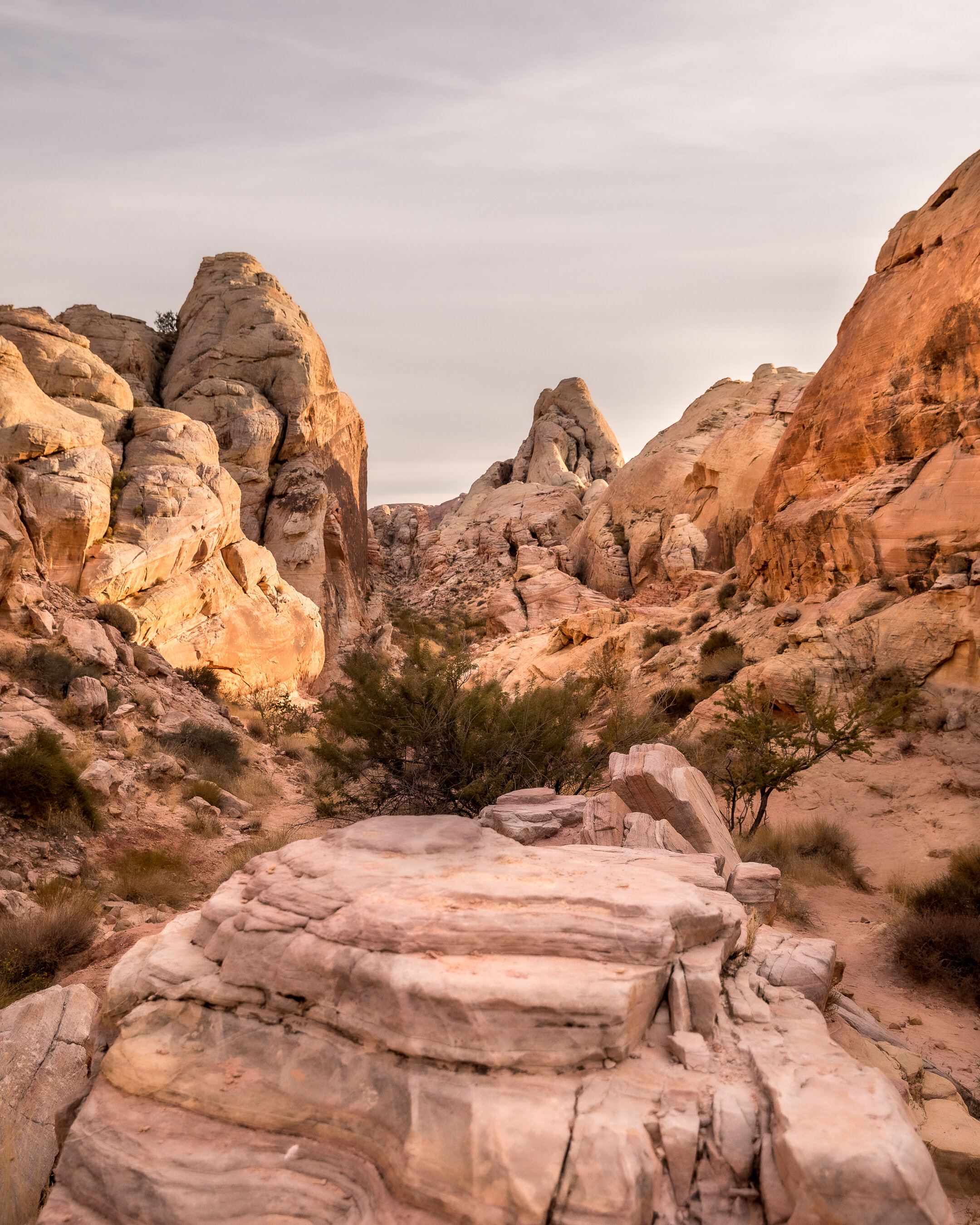
I fell in love with this place for so many reasons. The ten mile scenic drive is stunning in and of itself. It reminds me of many places in Arizona on a lesser scale. Most of the hikes are short and not too difficult, perfect for someone like myself, who is not in the greatest of shape. You can definitely see the park in a day if you make it early enough. The park was empty on both of your trips which shocked me that such an amazing place wouldn’t have more visitors. I’m not complaining though, happy to keep this place to myself and all of you reading this of course =)
Sharing the best spots to hike to at Valley of Fire State Park below. If you’re visiting Las Vegas and looking for fun and safe activities to do outdoors, I definitely recommend coming here.
PINK CANYON

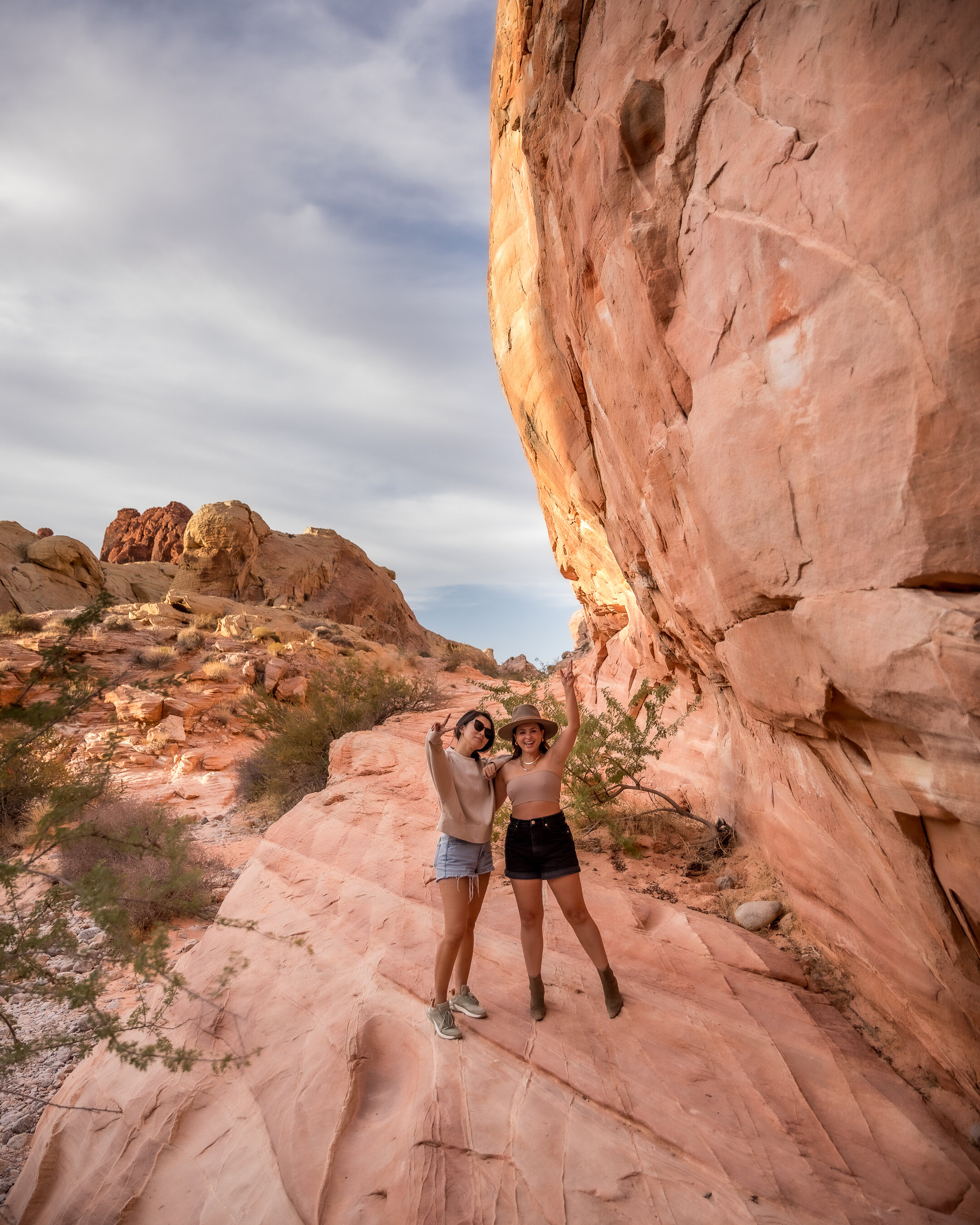
Pink Canyon is not on the park map, not sure why as it’s one of the most picturesque places inside the park. We found out about it through a blog post a visitor made. The post explained how to get there in detail but since it’s not marked, it still took two times to find it. From the visitor’s center, make your way down Mouse’s Tank Road, you will then notice a few dips in the road. Once you pass the 4th dip, you can park on the right or left side of the road on the gravel, not on the sand. It’s basically situated between Fire Canyon Road and parking lot #3 so if you make it to lot #3 then you know you’ve gone too far. The blog post said it’s about 4 miles from the entrance and provided these exact coordinates here. Since there is no cell phone service inside the park, make sure to download the location on Google maps prior so you’re prepared. The entrance to the trailhead is on the right hand side from the visitor’s center. Follow the footpaths and its about a 10 minute walk to the entrance of the canyon, exactly where my picture was taken.
FIRE WAVE TRAIL

This hike was easy to find, park at lot #3, cross the street and follow the signs that will lead you to this spot. It’s about a 1.5 mile hike in total but felt a little longer because you’re walking through sand for the majority of the hike. It was super hot when we did this hike on our first trip so I was a bit winded, but if you’re in good shape, this will be an easy trek for you. Fire Wave Trail reminds me of the Waves at Coyote Buttes but on a smaller scale of course. It definitely satisfied my urge of seeing these beautifully waved formatted rocks and no winning a lottery was needed.
MOUSE’S TANK ROAD


This is the spot I saw on Instagram and the most photographed spot in the park. It was one of the main reasons I wanted to visit Valley of Fire. During our first visit we drove up and down Mouse’s Tank Road and couldn’t find it for the life of us. For some reason we kept missing it but finally found it as it got dark outside. It was too late to take pictures so we knew a second trip would have to happen. From the visito'r’s center, drive down Mouse’s Tank Road and it will be on the left hand side before you hit the Rainbow Vista Trail parking lot. You can park there and walk back down or you can park on the side of the road. It’s not a difficult climb up, just a few rocks and you’re there to see the view from above. My husband was with us the second time as our third wheel so Crystal and I got to take a picture together at our favorite place.
WHITE DOMES TRAIL
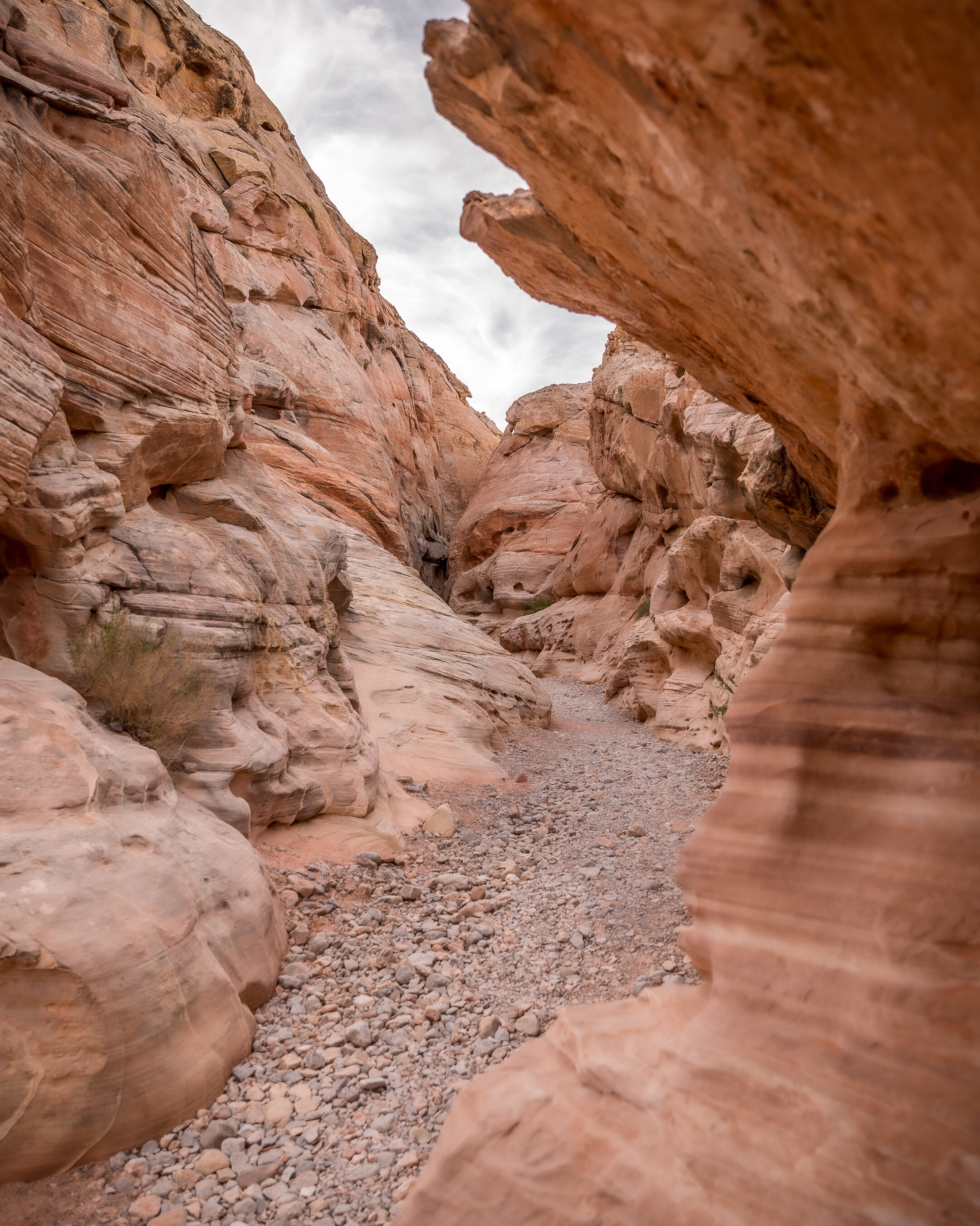
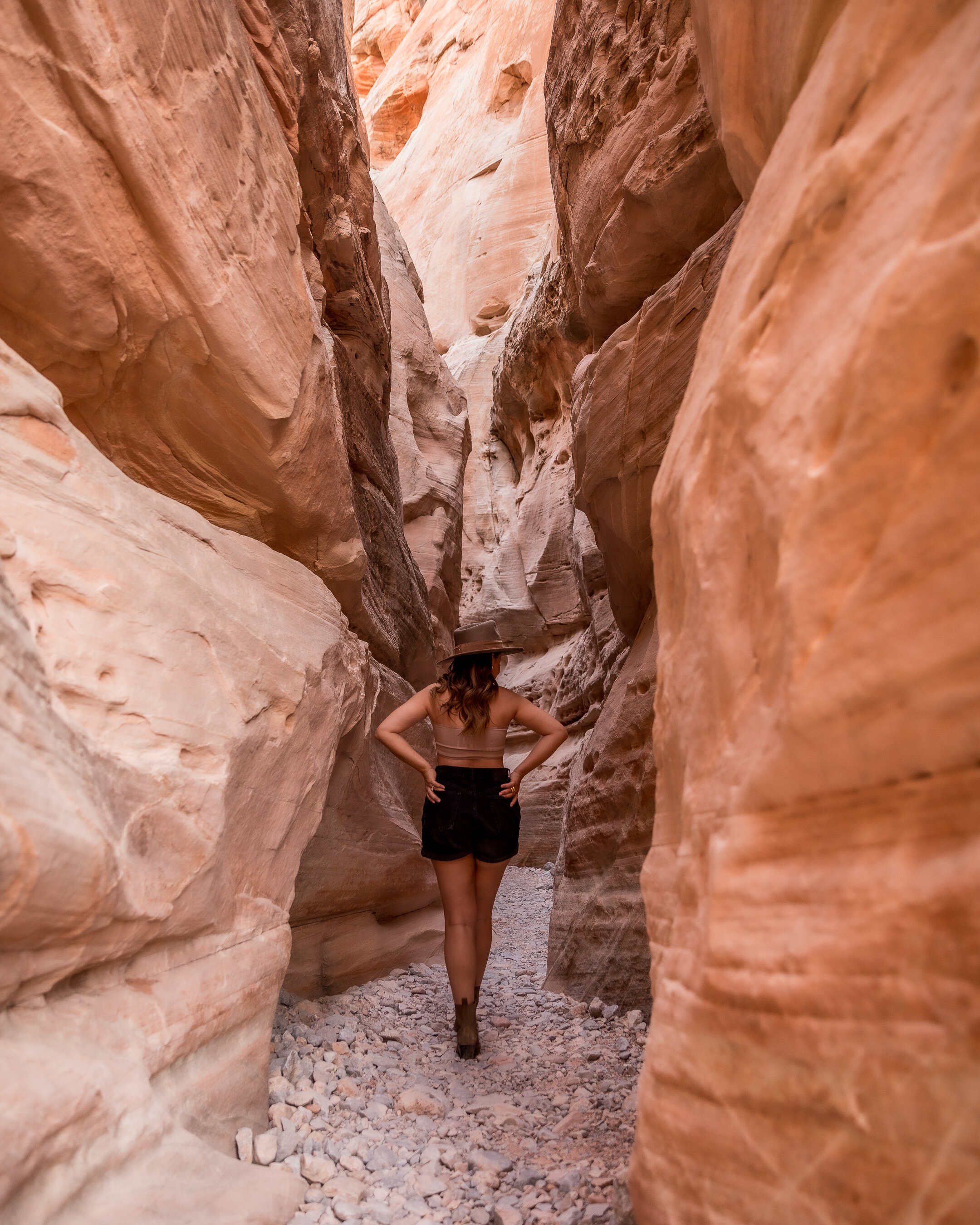

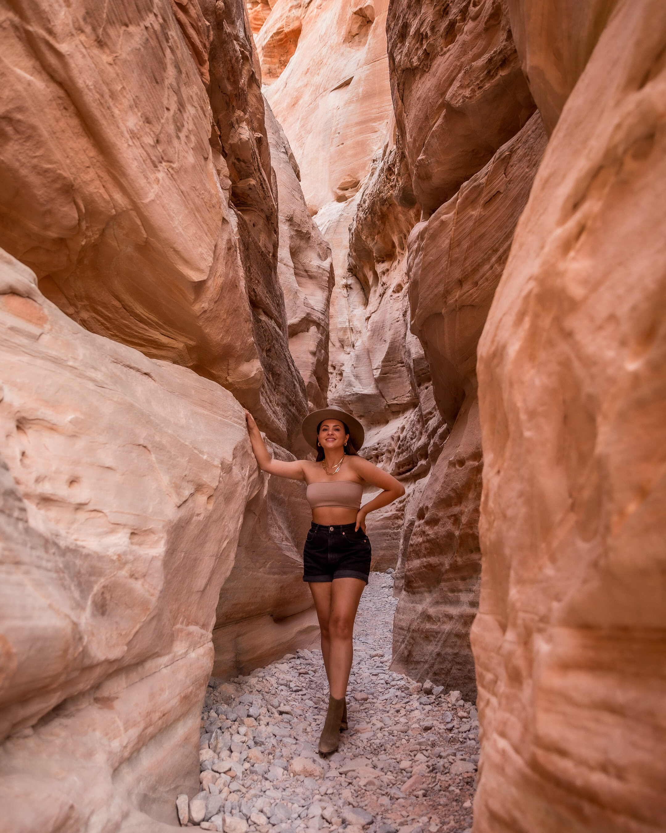
White Domes Trail is located at the very end of Mouse’s Tank Road. You park in the parking lot and follow the signs from the trailhead to the slot canyon. This was an easy 1.2 mile hike on flat terrain with amazing rock formations at every turn. The slot canyon reminded me of Antelope Canyon in Arizona and we couldn’t resist getting a few photos.
ADDITIONAL INFO
The park is open from sunrise to sunset and costs $10 to enter. The best way to get there is off highway 15 from Vegas and you’ll head towards the east entrance. There’s a gas station off the exit and the only one so make sure to fuel up before heading to the park.
As mentioned above, cell phone service is rare throughout the park. Be prepared to be off the grid during your visit. Honestly, it made me so much more present to enjoy nature and all the beautiful sights around me.
Most of the parking lots have bathrooms but I wouldn’t suggest using them. The visitor center had the best and cleanest bathroom plus a gift shop to buy water and snacks.
Check the weather before you go. Our visit in early October was super hot in the 90s-100s and I didn’t bring enough water. Our second visit in late October was perfect in the 70s-80s. It seems the best time to visit parks are in early fall and spring.
Thanks for stopping by!